Pickup: Tokyo branch | Return: Tokyo branch | Best for: northern coastlines, seafood, national parks and open roads
By the Samurai Campers Operations Team | Updated 2026
Pickup: Tokyo branch | Return: Tokyo branch | Best for: northern coastlines, seafood, national parks and open roads
By the Samurai Campers Operations Team | Updated 2026
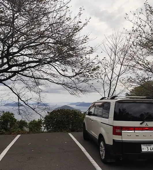
Hokkaido looks small on a map of Japan. It isn’t. The island is 83,000 square kilometres larger than Ireland, larger than Austria, comparable to Scotland and Wales combined. The drives between major stops are routinely 4–6 hours. Petrol stations thin out north of Asahikawa. Mobile reception drops in the Shiretoko peninsula. Anyone who tells you they ‘did Hokkaido in a week’ did the south coast and called it done.
This 21-day route doesn’t try to do everything. It does the Sanriku Coast in Tohoku easily the most beautiful coastline in mainland Japan then crosses to Hokkaido for the wild parts: Shakotan, Wakkanai, Shiretoko, Kushiro. Sapporo is on the route but only as a logistics stop. If you came for the city, this isn’t your itinerary.
Pickup and return at our Tokyo branch. The Aomori-to-Hakodate ferry is integral to the route. Confirm with our team that your rental plan permits the ferry crossing not all plans do.
The Sanriku Coast running from Hachinohe in Aomori down to Soma in Fukushima is one of Japan’s most dramatic coastlines, and one of its least visited by international travellers. The geography is responsible: it’s a ria coast, formed by drowned river valleys, which produces sharp cliffs, deep inlets, and pale rock formations. Jodogahama, near Miyako, has the kind of clear blue water people fly to Croatia or Sardinia for.
The coast was severely damaged by the 2011 tsunami. Driving through Rikuzentakata and Ofunato today means seeing a working coastline shaped by that recovery. The sea walls are new. The towns are partly rebuilt. The fishing fleets are back. It’s a region worth driving slowly and respectfully, not a region to rush.
Tokyo → Sendai → Matsushima → Sanriku Coast → Miyako → Hachinohe → Aomori → [Ferry] → Hakodate → Lake Toya → Sapporo → Shakotan → Otaru → Wakkanai → Abashiri → Shiretoko → Kushiro → Furano/Biei → Hakodate → [Ferry] → Aomori → Tokyo
 Road trip map
Collect the campervan from the Tokyo branch. Day one is a setup day, not a driving day. Stock the vehicle for the longer journey Hokkaido stretches are not the place to discover you’re short on something basic.
If you’re new to campervan travel, read the beginner’s guide to campervans before departure. Confirm your ferry booking timing and route before leaving Tokyo.
Day 1 overnight: Odaiba Seaside Park RV Area ¥3,000/night
First proper driving day. About 350 km on the Tohoku Expressway. Treat this as a transition day, not a destination day. Sendai itself is a working city gyutan (grilled beef tongue) is the local speciality, and it’s genuinely worth eating, not just a marketing item. The technique was developed by a single Sendai restaurant in the 1940s using cuts other shops were discarding.
Where to eat gyutan: Gyutan Lunch: Aji no Gyutan, Sendai
Day 2 overnight:Sendai Green Park RV ¥4,200/night
Matsushima is one of the ‘three views of Japan’ a classification from the 17th century that named the three most scenic landscapes in the country. The other two are Amanohashidate in Kyoto and Miyajima in Hiroshima. Whether you agree with that ranking or not, Matsushima Bay is genuinely beautiful small pine-covered islands scattered across protected water, viewpoints from hillside pavilions, a working oyster industry.
Half a day is enough. The seafood especially oysters in winter is the food anchor.
Day 3 overnight: Matsushima Bay RV Park ¥3,800/night
The route turns north along the coast. Ishinomaki is the largest town on the southern Sanriku and a useful resupply stop. From here the coastline gets dramatic and quieter. Drive slowly. The roads are narrower than the highway you’ve been on, and the views from the coastal sections genuinely reward the lower speed.
Day 4 overnight: Sanriku Coast Campground ¥3,900/night
Kesennuma is one of Japan’s major bonito and shark fin ports. The morning market starts early. The local katsuo (bonito) preparation particularly katsuo tataki, where the fish is seared on the outside and raw in the centre is genuinely better here than the version you’ll get in Tokyo. Worth a slow lunch.
Where to eat: Uogashi Kaisendon Kesennuma Market
Day 5 overnight: Kesennuma Bay RV Park ¥4,000/night
This is the section of the route most directly shaped by the 2011 tsunami. Rikuzentakata’s town centre was rebuilt on raised ground. The Iwate Tsunami Memorial Museum, opened in 2019, is one of the more honest disaster memorials in Japan it doesn’t romanticise. Worth two hours.
Drive slowly through the coastal towns. This isn’t a region to power through.
Day 6 overnight: Ofunato Coastal RV ¥4,000/night
Jodogahama is the standout of the Sanriku coast a beach of pale white rocks framing impossibly clear blue water. The geological term is rhyolite, the result of ancient volcanic activity. Walk the loop trail in the morning before crowds arrive. The water is genuinely swimmable in summer.
If you’re going to take one photo from this entire trip that surprises your friends, it’ll be Jodogahama in morning light.
Day 7 overnight: Miyako Seaside RV Park ¥3,900/night
North of Miyako, the coastline gets even more dramatic. Kitayamazaki has cliff viewpoints up to 200 metres high. The Michinoku Coastal Trail a 1,000 km walking route established after the 2011 tsunami to support coastal communities runs through here. You’re not walking the trail (it would take 6 weeks), but the viewpoints at Kitayamazaki are some of the best.
Driving here is slower than the map suggests. The roads are narrow, winding, and the views constantly demand pull-offs. Don’t try to cover too much ground.
Day 8 overnight: Northern Iwate Coastal RV ¥4,200/night
Hachinohe’s Sunday morning market (Minato Asaichi, March–December) is one of the largest in northern Japan over 300 stalls along the harbour. If you time your route to hit it, this is the local-food highlight of the Tohoku section. If you can’t, the daily Mutsu-Minato-eki Asaichi runs year-round and is excellent.
Then drive to Aomori. Refuel, restock supplies, do laundry, check your ferry booking. Tomorrow is the crossing.
Day 9 overnight: Aomori Port RV Area ¥4,100/night
Take the Tsugaru Kaikyo Ferry. The crossing takes about 3 hours 40 minutes. The Seikan Tunnel the world’s longest undersea tunnel runs under you, carrying the Shinkansen. The ferry above it is the older route, and the more interesting one if you have a vehicle.
Hakodate in the afternoon. The morning market at the harbour runs early squid sashimi, ikura don, fresh scallops. If you can’t make it for breakfast, the harbour-side seafood restaurants serve through lunch.
Hakodate morning market first. Then drive to Lake Toya about 2.5 hours. Lake Toya is a 70 km² caldera lake formed roughly 110,000 years ago. Mount Usu, on the southern shore, is one of Japan’s most active volcanoes, with major eruptions in 1910, 1944, 1977, and 2000.
This is the day to do laundry, restock, and prepare for the more remote Hokkaido sections. The campervan-friendly facilities at Lake Toya are some of the best you’ll find before the wild coast.
Day 11 overnight: Lake Toya Camper Area ¥4,200/night
Drive to Sapporo. The city is on this route only because it’s a useful logistics stop supermarkets, outdoor stores, fuel, urban food culture. Park outside the centre and use the subway. Don’t waste an afternoon driving in Sapporo proper.
Sapporo miso ramen, soup curry, and jingisukan (grilled lamb) are the food anchors. All three are local inventions, not just regional adaptations.
Where to eat:
Day 12 overnight: Sapporo Periphery RV Park ¥4,500/night
Otaru in the morning canal district, sushi, glass-making workshops. The town was a major commercial port in the late 19th century, and the warehouse district has been preserved.
Then drive the Shakotan Peninsula. This is one of Hokkaido’s best coastal drives the water at Cape Kamui and Cape Shakotan is the famous ‘Shakotan blue,’ the result of mineral content and the way the seabed reflects sunlight. It works in clear weather. In fog, it looks like grey water. Check forecasts before committing.
Day 13 overnight: Yoichi Seaside Campground ¥4,000/night
This is a movement day. The drive up Hokkaido’s west coast toward Wakkanai is genuinely long roughly 400 km of coastal road, with services spread out. Fill fuel before you need it. Pack lunch. Stop at scenic viewpoints rather than trying to make destination time.
Day 14 overnight: Northern Hokkaido Coastal Campground ¥4,200/night
Northernmost point of Japan that you can drive to. Cape Soya is the actual northern tip there’s a monument, a Russian-direction sign (Sakhalin Island is visible across the strait on clear days), and a strong sense of being somewhere far from anywhere.
Wakkanai is also the gateway to Rishiri and Rebun islands both worth visiting, but on a separate ferry trip. Don’t try to add them to this 21-day route without extending.
Where to eat sea urchin: Uni Donburi at Maruka Seafood, Wakkanai
Day 15 overnight: Wakkanai Bay RV ¥4,500/night
Turn east along the Okhotsk side. Different feel from the west coast colder sea air, smaller fishing towns, open agricultural fields. A driving day more than a sightseeing day.
Day 16 overnight: Okhotsk Coast RV Camp ¥4,000/night
Abashiri sits on the Okhotsk Sea. In winter (January–March), the sea here ices over the southernmost place in the northern hemisphere where drift ice arrives naturally. You won’t see that in late spring or summer, but the museums and the coastline still tell that story. The Okhotsk Ryuhyo Museum covers the drift-ice ecology if you’re curious.
Day 17 overnight: Abashiri Sea Campground ¥4,100/night
Shiretoko is the strongest natural highlight of the entire route, and the place to take seriously. UNESCO Natural Heritage site since 2005. Japan’s densest brown bear population. The peninsula’s eastern tip is unreachable by road you’d need a boat but the road as far as the Shiretoko Goko (Five Lakes) area is one of the most dramatic drives in Japan.
Bear safety is real. Check the daily report at the Shiretoko Nature Centre before any walk. Some trails close when bears are sighted nearby. Do not carry food in open bags on trails. Store all food in scent-proof containers in the vehicle.
The Shiretoko peninsula is the closest thing Japan has to wilderness on the European or American sense. Take it seriously.
Day 18 overnight: Utoro Camper Park ¥4,500/night
Drive from Shiretoko toward Kushiro. The landscape shifts from dramatic coast to flat wetlands Kushiro Shitsugen is Japan’s largest wetland and home to the red-crowned crane. The cranes are most visible in winter when they gather at feeding sites, but you’ll see other waterbirds year-round.
Kushiro itself is a working port city. The robatayaki (charcoal grill) tradition originated here small fish, vegetables, and seafood grilled at a counter in front of you. Worth one slow dinner.
Day 19 overnight: Kushiro Wetlands RV Park ¥4,200/night
The return decision: route through central Hokkaido via Furano and Biei (longer, more scenic flower fields in July, lavender, rolling agricultural landscape) or drive more directly toward Hakodate (shorter, lets you protect energy for the ferry day).
If you have stamina, take the Furano/Biei route. If you’re tired and after Shiretoko, you might be take the direct route. The ferry day tomorrow is long.
Day 20 overnight: Furano Hills Campground ¥4,300/night
The return ferry from Hakodate to Aomori, then the long drive south to Tokyo. This is a roughly 12–14 hour total travel day. Build in buffer. Refuel and clean the vehicle along the way, not at the very end.
Return the campervan to our Tokyo branch. Allow generous time for the inspection.
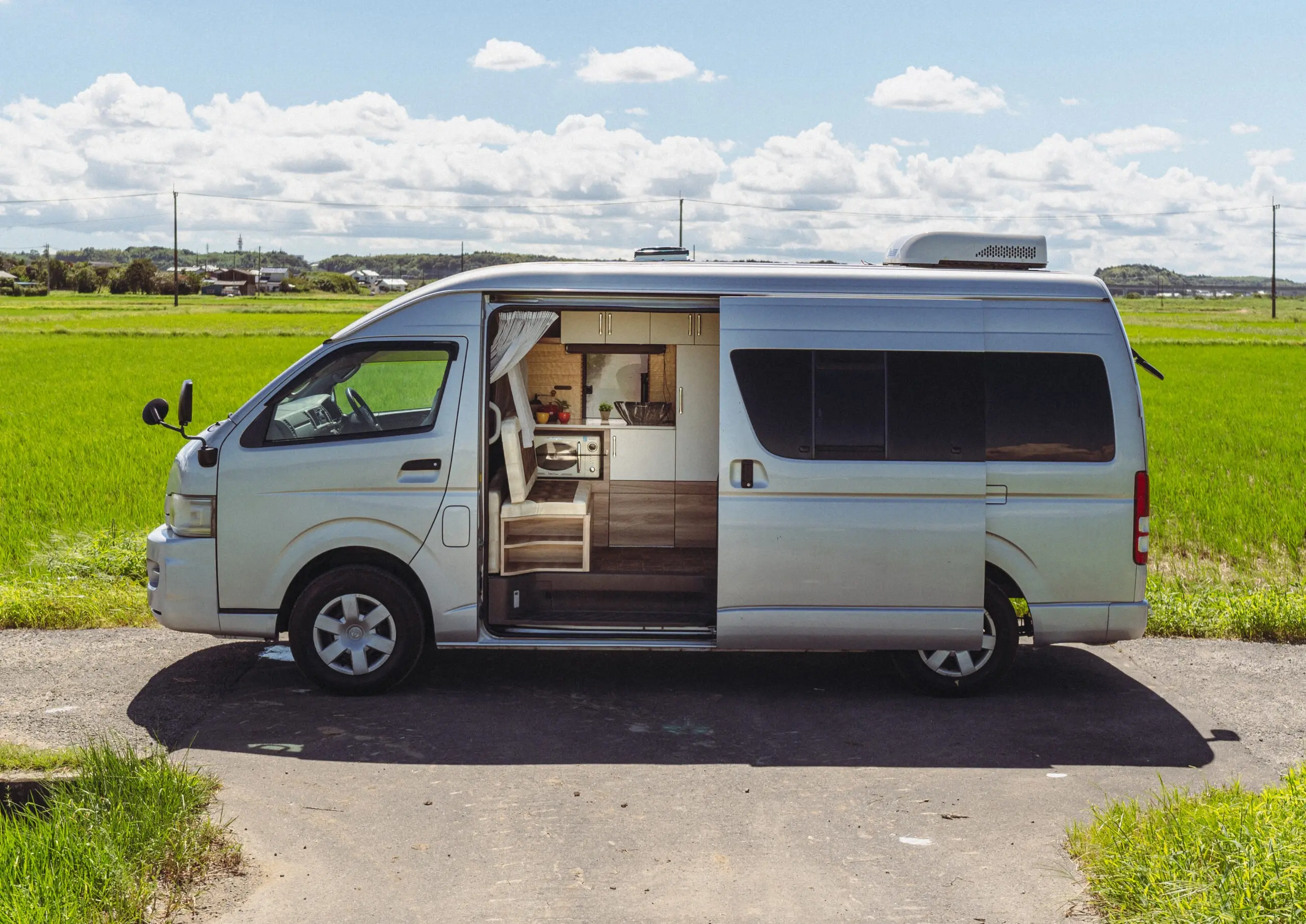
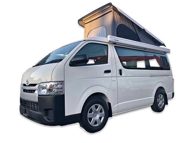
Pickup and return at our Tokyo branch. Contact us to confirm ferry permission on your plan before booking. Browse the fleet longer Hokkaido distances favour the larger mid-size models.
Have Questions?
Yes, but plan an extra 3–4 days. The islands have their own ferry from Wakkanai. Not all rental plans permit vehicle transport to the small islands confirm before booking.
Yes, but plan an extra 3–4 days. The islands have their own ferry from Wakkanai. Not all rental plans permit vehicle transport to the small islands confirm before booking.
No, not as written. Many Hokkaido coastal roads close or require winter tyres and chains. Shiretoko largely closes. The ferry runs year-round but the rest of the route becomes a serious winter driving challenge. Plan a different itinerary if you’re travelling December–March.
You can drive from Tokyo to Hokkaido and back in less time, but you’ll spend most of it looking at the tarmac of the Tohoku Expressway. The 21-day timeframe accounts for the reality of Hokkaido distances, where a single leg often requires five hours of focused driving. It allows for rest days in places like Shiretoko and the Sanriku Coast, ensuring you aren’t too exhausted to actually enjoy the scenery once you arrive.
Not automatically. While the Tsugaru Kaikyo Ferry is a public service, many rental agreements have specific restrictions regarding sea crossings or geographic limits. You must confirm ferry permission with the Samurai Campers team during the planning stage to ensure your insurance and rental plan cover the island transit. We handle the vehicle length brackets and logistics with you before you pick up the keys in Tokyo.
Distance and wildlife are the two biggest factors. Petrol stations become scarce once you move north of Asahikawa, making it vital to refuel whenever you see a station rather than waiting for the light to come on. In Shiretoko, the brown bear population is dense and active; you need to check the daily trail reports at the Nature Centre and carry a bear bell for any hikes. Mobile reception also becomes unreliable in these remote coastal stretches.
The window between late May and early October is the safest and most rewarding time for this specific itinerary. Outside of these months, you’ll encounter heavy snow in the mountain passes and potential road closures that make a 21-day schedule impossible to maintain. If you’re aiming for the famous flower fields in Furano or the best hiking conditions in the national parks, July and August are ideal, though you’ll need to book ferry tickets at least four weeks in advance.
For a 21-day trip, expect to spend between ¥40,000 and ¥60,000 on petrol depending on your vehicle’s size and your driving style. Most campervan-friendly RV parks and campgrounds along this route charge between ¥3,800 and ¥4,500 per night. These costs are separate from ferry fares, which vary based on the length of the campervan you choose.
8 days, one-way Tokyo to Aomori through five volcanic national parks. Best May–October only.
Tokyo to Osaka in 12 days on the historic Tokaido. Three intact sections, one real road trip.
A 16-day Tokyo circuit built around Koyasan, Kumano Kodo, and Ise Japan's deepest sacred trail.